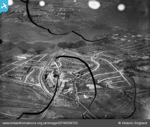
EPW038702 ENGLAND (1932). The Circle and housing off the North Circular Road, Neasden, from the south, 1932. This image has been produced from a damaged negative.
© Copyright OpenStreetMap contributors and licensed by the OpenStreetMap Foundation. 2025. Cartography is licensed as CC BY-SA.
Details
| Title | [EPW038702] The Circle and housing off the North Circular Road, Neasden, from the south, 1932. This image has been produced from a damaged negative. |
| Reference | EPW038702 |
| Date | June-1932 |
| Link | |
| Place name | NEASDEN |
| Parish | |
| District | |
| Country | ENGLAND |
| Easting / Northing | 521424, 185784 |
| Longitude / Latitude | -0.24826575005659, 51.557376118374 |
| National Grid Reference | TQ214858 |
Pins

Leslie B |
Sunday 2nd of December 2018 06:23:53 PM | |

Class31 |
Monday 13th of October 2014 11:45:44 AM | |

Class31 |
Monday 13th of October 2014 11:44:55 AM | |

Class31 |
Sunday 2nd of March 2014 11:45:09 PM |


![[EPW038702] The Circle and housing off the North Circular Road, Neasden, from the south, 1932. This image has been produced from a damaged negative.](http://britainfromabove.org.uk/sites/all/libraries/aerofilms-images/public/100x100/EPW/038/EPW038702.jpg)
![[EPW056898] Construction of new housing by The Grange and Prout Grove, Dudden Hill, 1938](http://britainfromabove.org.uk/sites/all/libraries/aerofilms-images/public/100x100/EPW/056/EPW056898.jpg)
![[EPW056897] Construction of new housing by The Grange and Prout Grove, Dudden Hill, 1938](http://britainfromabove.org.uk/sites/all/libraries/aerofilms-images/public/100x100/EPW/056/EPW056897.jpg)
![[EPW046500] The North Circular Road and environs, Neasden, from the south-east, 1935](http://britainfromabove.org.uk/sites/all/libraries/aerofilms-images/public/100x100/EPW/046/EPW046500.jpg)
