
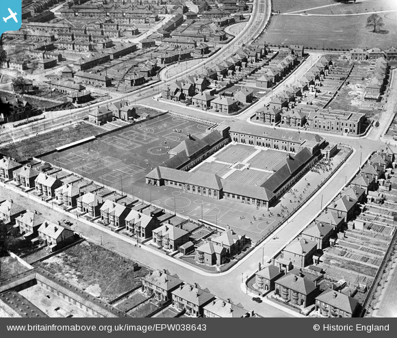
EPW038643 ENGLAND (1932). Bennetthorpe School on Danum Road, Doncaster, 1932
© Copyright OpenStreetMap contributors and licensed by the OpenStreetMap Foundation. 2026. Cartography is licensed as CC BY-SA.
Nearby Images (6)
EPW038643

EPW038649

EPW038647

EPW038660

EPW038648

EPW038645

Details
| Title | [EPW038643] Bennetthorpe School on Danum Road, Doncaster, 1932 |
| Reference | EPW038643 |
| Date | June-1932 |
| Link | |
| Place name | DONCASTER |
| Parish | |
| District | |
| Country | ENGLAND |
| Easting / Northing | 458820, 402704 |
| Longitude / Latitude | -1.1127947755547, 53.517467742378 |
| National Grid Reference | SE588027 |
Pins

jonron |
Saturday 5th of August 2023 03:00:14 AM | |
|
Fishermanjef |
Tuesday 19th of July 2016 12:32:03 PM | |
|
Stuart |
Tuesday 4th of June 2013 05:12:17 PM |