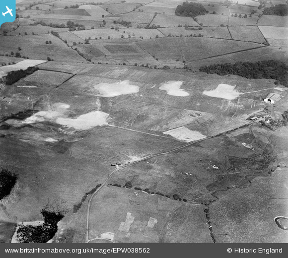
EPW038562 ENGLAND (1932). Woodford Aerodrome Woodford, 1932
© Copyright OpenStreetMap contributors and licensed by the OpenStreetMap Foundation. 2026. Cartography is licensed as CC BY-SA.
Nearby Images (8)
Details
| Title | [EPW038562] Woodford Aerodrome Woodford, 1932 |
| Reference | EPW038562 |
| Date | June-1932 |
| Link | |
| Place name | WOODFORD |
| Parish | |
| District | |
| Country | ENGLAND |
| Easting / Northing | 389554, 381676 |
| Longitude / Latitude | -2.1568737245233, 53.331623587926 |
| National Grid Reference | SJ896817 |
Pins

IanL |
Friday 28th of November 2014 08:47:08 PM | |

IanL |
Friday 28th of November 2014 08:46:35 PM | |

IanL |
Friday 28th of November 2014 08:42:31 PM | |

IanL |
Friday 28th of November 2014 08:29:21 PM | |

IanL |
Friday 28th of November 2014 08:28:00 PM | |

IanL |
Friday 28th of November 2014 08:27:07 PM | |

IanL |
Friday 28th of November 2014 08:26:36 PM |


![[EPW038562] Woodford Aerodrome Woodford, 1932](http://britainfromabove.org.uk/sites/all/libraries/aerofilms-images/public/100x100/EPW/038/EPW038562.jpg)
![[EPW038558] Woodford Aerodrome and surrounding countryside, Woodford, 1932](http://britainfromabove.org.uk/sites/all/libraries/aerofilms-images/public/100x100/EPW/038/EPW038558.jpg)
![[EPW038559] Woodford Aerodrome, Woodford, 1932](http://britainfromabove.org.uk/sites/all/libraries/aerofilms-images/public/100x100/EPW/038/EPW038559.jpg)
![[EPW038557] Woodford Aerodrome, Woodford, 1932](http://britainfromabove.org.uk/sites/all/libraries/aerofilms-images/public/100x100/EPW/038/EPW038557.jpg)
![[EPW038561] Woodford Aerodrome and surrounding countryside, Woodford, 1932](http://britainfromabove.org.uk/sites/all/libraries/aerofilms-images/public/100x100/EPW/038/EPW038561.jpg)
![[EPW017807] Woodford, Avro 504N biplanes lined up at the A.V. Roe Co Ltd aerodrome, 1927](http://britainfromabove.org.uk/sites/all/libraries/aerofilms-images/public/100x100/EPW/017/EPW017807.jpg)
![[EPW017808] Woodford, Avro 504N biplanes lined up at the A.V. Roe Co Ltd aerodrome, 1927](http://britainfromabove.org.uk/sites/all/libraries/aerofilms-images/public/100x100/EPW/017/EPW017808.jpg)
![[EPW017809] Woodford, Avro 504N biplanes lined up at the A.V. Roe Co Ltd aerodrome, 1927](http://britainfromabove.org.uk/sites/all/libraries/aerofilms-images/public/100x100/EPW/017/EPW017809.jpg)