
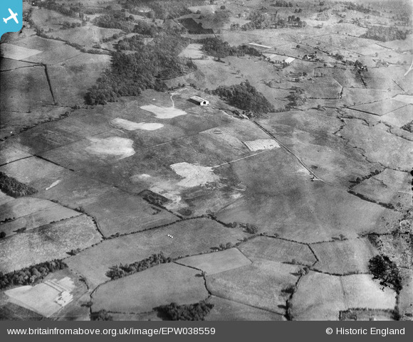
EPW038559 ENGLAND (1932). Woodford Aerodrome, Woodford, 1932
© Copyright OpenStreetMap contributors and licensed by the OpenStreetMap Foundation. 2026. Cartography is licensed as CC BY-SA.
Nearby Images (6)
EPW038559

EPW038557

EPW038558

EPW038562

EPW038561

EPW038560

Details
| Title | [EPW038559] Woodford Aerodrome, Woodford, 1932 |
| Reference | EPW038559 |
| Date | June-1932 |
| Link | |
| Place name | WOODFORD |
| Parish | |
| District | |
| Country | ENGLAND |
| Easting / Northing | 389656, 381735 |
| Longitude / Latitude | -2.1553438636319, 53.332155983093 |
| National Grid Reference | SJ897817 |
Pins

IanL |
Friday 28th of November 2014 08:57:35 PM | |
|
IanL |
Friday 28th of November 2014 08:50:50 PM | |
|
IanL |
Friday 28th of November 2014 08:50:17 PM | |
|
IanL |
Friday 28th of November 2014 08:49:52 PM | |
|
IanL |
Friday 28th of November 2014 08:15:54 PM | |
|
IanL |
Friday 28th of November 2014 06:15:53 PM | |
|
IanL |
Friday 28th of November 2014 06:15:08 PM | |
|
IanL |
Friday 28th of November 2014 06:14:31 PM | |
|
IanL |
Friday 28th of November 2014 06:14:03 PM |
User Comment Contributions
This view shows the aerodrome as viewed from the NNW showing Old Hall Lane, which runs along the present day western airfield boundary, together with the meandering track of the River Dean. The AV Roe hangar/assembly shed is on the same site of the current flight sheds on the south side of the airfield. Sadly, with the cancellation of the Nimrod MRA4 project in 2010, the British Aerospace facility has been closed and sold for redevelopment. |
IanL |
Friday 28th of November 2014 06:13:14 PM |