
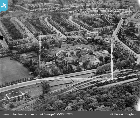
EPW038226 ENGLAND (1932). Woodside Hospital and environs, Muswell Hill, 1932. This image was marked by Aerofilms Ltd for photo editing.
© Copyright OpenStreetMap contributors and licensed by the OpenStreetMap Foundation. 2026. Cartography is licensed as CC BY-SA.
Nearby Images (19)
EPW038226

EPW038224

EPW038223

EPW038228

EPW038225

EPW038227

EPW038229

EPW009664

EPW048335

EPW048329

EPW048338

EPW048340

EPW048332

EPW048339

EPW048333

EPW048337

EPW048336

EPW048330

EPW048334

Details
| Title | [EPW038226] Woodside Hospital and environs, Muswell Hill, 1932. This image was marked by Aerofilms Ltd for photo editing. |
| Reference | EPW038226 |
| Date | June-1932 |
| Link | |
| Place name | MUSWELL HILL |
| Parish | |
| District | |
| Country | ENGLAND |
| Easting / Northing | 528339, 189244 |
| Longitude / Latitude | -0.14729629439462, 51.586942401322 |
| National Grid Reference | TQ283892 |
Pins
Be the first to add a comment to this image!