
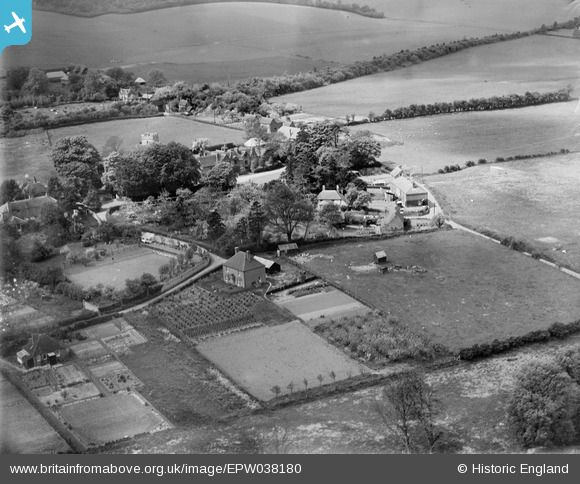
EPW038180 ENGLAND (1932). The village and surrounding countryside, Kingston, 1932
© Copyright OpenStreetMap contributors and licensed by the OpenStreetMap Foundation. 2025. Cartography is licensed as CC BY-SA.
Nearby Images (3)
EPW038180

EPW038179

EPW038181

Details
| Title | [EPW038180] The village and surrounding countryside, Kingston, 1932 |
| Reference | EPW038180 |
| Date | May-1932 |
| Link | |
| Place name | KINGSTON |
| Parish | KINGSTON |
| District | |
| Country | ENGLAND |
| Easting / Northing | 619882, 151340 |
| Longitude / Latitude | 1.1490207409452, 51.218330319205 |
| National Grid Reference | TR199513 |
Pins
Be the first to add a comment to this image!