
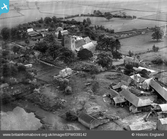
EPW038142 ENGLAND (1932). St Mary's Church and the village, Madley, 1932
© Copyright OpenStreetMap contributors and licensed by the OpenStreetMap Foundation. 2025. Cartography is licensed as CC BY-SA.
Nearby Images (3)
EPW038142

EPW038144

EPW038143

Details
| Title | [EPW038142] St Mary's Church and the village, Madley, 1932 |
| Reference | EPW038142 |
| Date | May-1932 |
| Link | |
| Place name | MADLEY |
| Parish | MADLEY |
| District | |
| Country | ENGLAND |
| Easting / Northing | 341949, 238701 |
| Longitude / Latitude | -2.8465060605156, 52.043242329803 |
| National Grid Reference | SO419387 |
Pins
Be the first to add a comment to this image!
User Comment Contributions
The little cottage in the foreground still stands today, although it has seen a little alteration to the layout since 1932. It is named Rosemary Cottage. This week Rosemary Cottage became my home. The fields and pond behind the cottage now have houses upon them. |

MJH |
Sunday 19th of April 2015 10:10:14 PM |