
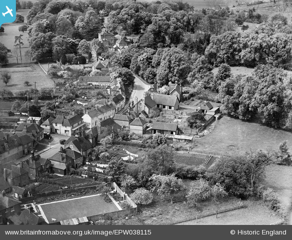
EPW038115 ENGLAND (1932). The village, Eyhorne Street, 1932
© Copyright OpenStreetMap contributors and licensed by the OpenStreetMap Foundation. 2025. Cartography is licensed as CC BY-SA.
Nearby Images (3)
EPW038115

EPW038118

EPW038117

Details
| Title | [EPW038115] The village, Eyhorne Street, 1932 |
| Reference | EPW038115 |
| Date | May-1932 |
| Link | |
| Place name | EYHORNE STREET |
| Parish | HOLLINGBOURNE |
| District | |
| Country | ENGLAND |
| Easting / Northing | 583277, 154681 |
| Longitude / Latitude | 0.62714513564335, 51.261270976759 |
| National Grid Reference | TQ833547 |
Pins
 Kentishman |
Friday 5th of September 2014 08:59:36 PM | |
Kentishman |
Friday 5th of September 2014 08:54:14 PM |