
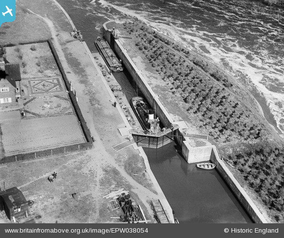
EPW038054 ENGLAND (1932). Vessels using Gunthorpe Lock, Gunthorpe, 1932
© Copyright OpenStreetMap contributors and licensed by the OpenStreetMap Foundation. 2025. Cartography is licensed as CC BY-SA.
Nearby Images (3)
EPW038054

EPW038055

EPW038053

Details
| Title | [EPW038054] Vessels using Gunthorpe Lock, Gunthorpe, 1932 |
| Reference | EPW038054 |
| Date | May-1932 |
| Link | |
| Place name | GUNTHORPE |
| Parish | GUNTHORPE |
| District | |
| Country | ENGLAND |
| Easting / Northing | 468785, 343762 |
| Longitude / Latitude | -0.97525339149276, 52.986464948937 |
| National Grid Reference | SK688438 |
Pins

John Wass |
Tuesday 13th of January 2015 08:52:17 PM |