
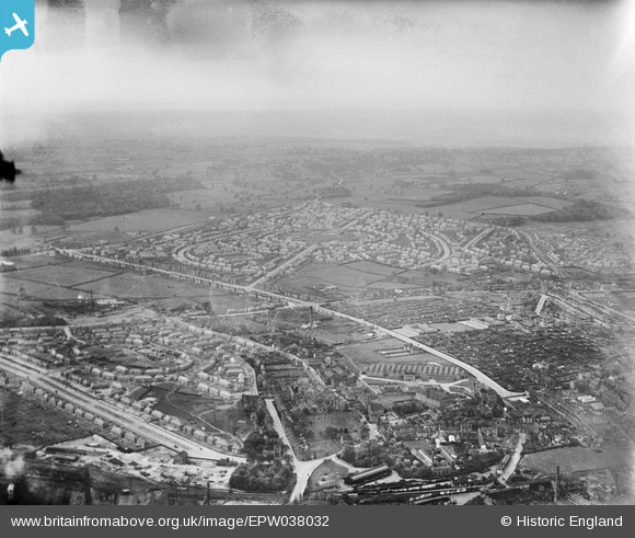
EPW038032 ENGLAND (1932). The new housing estate, Aspley, from the east, 1932
© Copyright OpenStreetMap contributors and licensed by the OpenStreetMap Foundation. 2026. Cartography is licensed as CC BY-SA.
Nearby Images (28)
EPW038032

EAW052444
 on Bar Lane and environs, Old Basford, 1953. This image was marked by Aerofilms Ltd for photo editing.")
EAW002787
 and the Saxby Ltd Dyeing Works off Bar Lane, Old Basford, 1946")
EAW052443
 on Bar Lane, Bracknell Crescent and environs, Old Basford, 1953. This image was marked by Aerofilms Ltd for photo editing.")
EAW002795
 and the surrounding area, Old Basford, from the south-east, 1946")
EAW052446
 on Bar Lane and environs, Old Basford, from the south, 1953. This image was marked by Aerofilms Ltd for photo editing.")
EAW052445
 on Bar Lane and environs, Old Basford, 1953. This image was marked by Aerofilms Ltd for photo editing.")
EAW052450
 and environs, Old Basford, 1953. This image was marked by Aerofilms Ltd for photo editing.")
EAW002791

EAW052451

EAW002793
, Bar Lane and the surrounding area, Old Basford, 1946")
EAW002788
 and the Saxby Ltd Dyeing Works off Bar Lane, Old Basford, 1946")
EPW021112

EAW002794
 and the surrounding area, Old Basford, from the west, 1946")
EAW002790

EAW052449
 on Bar Lane and environs, Old Basford, 1953. This image was marked by Aerofilms Ltd for photo editing.")
EPW020941

EPW020942

EPW020943

EPW021111

EAW052448

EAW002792
 and the Saxby Ltd Dyeing Works off Bar Lane, Old Basford, 1946")
EAW003245

EPW020944

EPW021110

EPW020945

EPW043607

EPW038035

Details
| Title | [EPW038032] The new housing estate, Aspley, from the east, 1932 |
| Reference | EPW038032 |
| Date | May-1932 |
| Link | |
| Place name | ASPLEY |
| Parish | |
| District | |
| Country | ENGLAND |
| Easting / Northing | 454896, 342696 |
| Longitude / Latitude | -1.1823242488607, 52.978485495177 |
| National Grid Reference | SK549427 |
Pins
Be the first to add a comment to this image!