
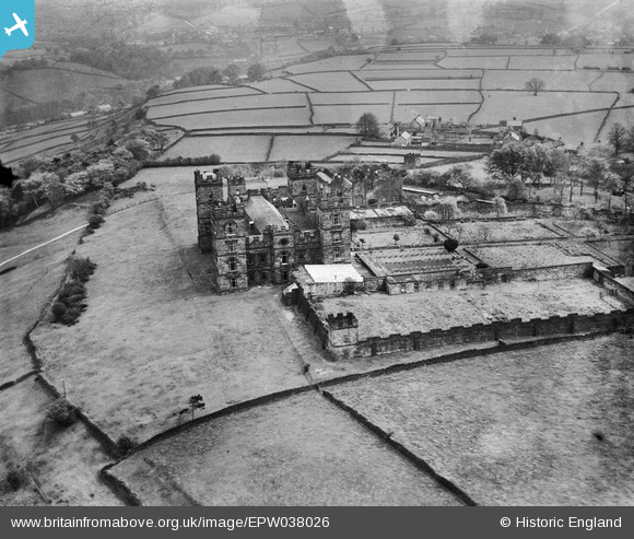
EPW038026 ENGLAND (1932). Riber Castle, Riber, 1932
© Copyright OpenStreetMap contributors and licensed by the OpenStreetMap Foundation. 2026. Cartography is licensed as CC BY-SA.
Nearby Images (3)
EPW038026

EPW041778

EPW038025

Details
| Title | [EPW038026] Riber Castle, Riber, 1932 |
| Reference | EPW038026 |
| Date | May-1932 |
| Link | |
| Place name | RIBER |
| Parish | MATLOCK TOWN |
| District | |
| Country | ENGLAND |
| Easting / Northing | 430655, 359038 |
| Longitude / Latitude | -1.5418206963045, 53.127332538855 |
| National Grid Reference | SK307590 |
Pins
Be the first to add a comment to this image!
User Comment Contributions
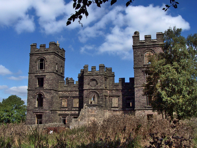
The castle in 2006. Public domain image, contributed by "AxG" |

totoro |
Thursday 30th of January 2014 10:03:52 PM |
RIBER CASTLE Riber Road, Matlock, Derbyshire DE4 5JU Grade 2 listed building - English Heritage Building ID: 429652 1868. Built by John Smedley. A large castellated mansion When listed in 1950 it was unoccupied and derelict. After the death of Smedley’s wife, the castle became a boys’ school until the 1930s. With the coming of WWII the Ministry of Defence used the site for storage. The MoD left following the war and the castle remained unused until the 1960s. From the 1960s to September 2000 it was home to a wildlife park, until “Riber Zoo”, as it was known, was sold by the owner. In 2008, the Castle, having no roof or floors, was purchased for development into apartments. |
totoro |
Thursday 30th of January 2014 10:02:49 PM |
Looking towards the North East |
totoro |
Thursday 30th of January 2014 07:43:00 PM |