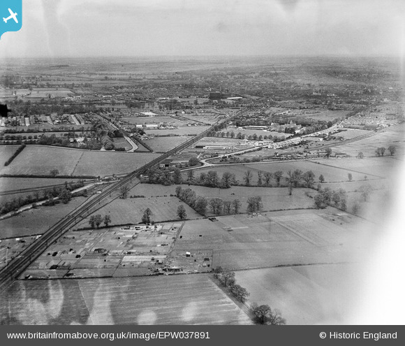
EPW037891 ENGLAND (1932). The Elstow Engineering Works, the town of Bedford and surrounding countryside, Elstow, from the south-east, 1932
© Copyright OpenStreetMap contributors and licensed by the OpenStreetMap Foundation. 2026. Cartography is licensed as CC BY-SA.
Details
| Title | [EPW037891] The Elstow Engineering Works, the town of Bedford and surrounding countryside, Elstow, from the south-east, 1932 |
| Reference | EPW037891 |
| Date | May-1932 |
| Link | |
| Place name | ELSTOW |
| Parish | ELSTOW |
| District | |
| Country | ENGLAND |
| Easting / Northing | 504367, 246893 |
| Longitude / Latitude | -0.475803477853, 52.1100902377 |
| National Grid Reference | TL044469 |
Pins

Class31 |
Tuesday 3rd of November 2015 07:44:16 AM | |

K9-Q |
Tuesday 3rd of November 2015 03:40:37 AM | |

K9-Q |
Tuesday 3rd of November 2015 03:38:25 AM | |

K9-Q |
Tuesday 3rd of November 2015 03:31:07 AM | |

K9-Q |
Tuesday 3rd of November 2015 03:28:07 AM | |

Jet |
Tuesday 3rd of March 2015 02:26:42 PM | |

Jet |
Tuesday 3rd of March 2015 02:21:28 PM | |

melgibbs |
Sunday 8th of December 2013 04:15:16 PM | |

melgibbs |
Sunday 8th of December 2013 04:14:22 PM | |

melgibbs |
Sunday 8th of December 2013 04:13:55 PM | |

melgibbs |
Sunday 8th of December 2013 04:13:29 PM | |

melgibbs |
Sunday 8th of December 2013 04:12:47 PM |
User Comment Contributions
See image EPW037892 for comments. |

melgibbs |
Thursday 11th of July 2013 09:46:57 PM |


![[EPW037891] The Elstow Engineering Works, the town of Bedford and surrounding countryside, Elstow, from the south-east, 1932](http://britainfromabove.org.uk/sites/all/libraries/aerofilms-images/public/100x100/EPW/037/EPW037891.jpg)
![[EPW037890] The Elstow Engineering Works, the town of Bedford and surrounding countryside, Elstow, from the south-east, 1932](http://britainfromabove.org.uk/sites/all/libraries/aerofilms-images/public/100x100/EPW/037/EPW037890.jpg)
![[EPW037892] The Elstow Engineering Works, the town of Bedford and surrounding countryside, Elstow, from the south-east, 1932](http://britainfromabove.org.uk/sites/all/libraries/aerofilms-images/public/100x100/EPW/037/EPW037892.jpg)