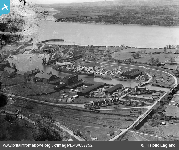
EPW037752 ENGLAND (1932). The docks, Sharpness, 1932
© Copyright OpenStreetMap contributors and licensed by the OpenStreetMap Foundation. 2026. Cartography is licensed as CC BY-SA.
Nearby Images (8)
Details
| Title | [EPW037752] The docks, Sharpness, 1932 |
| Reference | EPW037752 |
| Date | May-1932 |
| Link | |
| Place name | SHARPNESS |
| Parish | HINTON |
| District | |
| Country | ENGLAND |
| Easting / Northing | 367236, 202621 |
| Longitude / Latitude | -2.4743604075133, 51.72089692369 |
| National Grid Reference | SO672026 |
Pins

gBr |
Sunday 28th of August 2016 08:10:30 PM |


![[EPW037752] The docks, Sharpness, 1932](http://britainfromabove.org.uk/sites/all/libraries/aerofilms-images/public/100x100/EPW/037/EPW037752.jpg)
![[EPW005400] The Severn Rail Bridge and the Dock Basin, Sharpness, 1921](http://britainfromabove.org.uk/sites/all/libraries/aerofilms-images/public/100x100/EPW/005/EPW005400.jpg)
![[EPW029347] Timber yards at Sharpness Docks, Sharpness, 1929](http://britainfromabove.org.uk/sites/all/libraries/aerofilms-images/public/100x100/EPW/029/EPW029347.jpg)
![[EAW006849] Sharpness Docks and the Severn Railway Bridge, Sharpness, from the south, 1947](http://britainfromabove.org.uk/sites/all/libraries/aerofilms-images/public/100x100/EAW/006/EAW006849.jpg)
![[EPW037755] The docks, Sharpness, 1932](http://britainfromabove.org.uk/sites/all/libraries/aerofilms-images/public/100x100/EPW/037/EPW037755.jpg)
![[EPW029341] Sharpness Docks, Sharpness, 1929](http://britainfromabove.org.uk/sites/all/libraries/aerofilms-images/public/100x100/EPW/029/EPW029341.jpg)
![[EPW029346] Sharpness Docks, Sharpness, 1929](http://britainfromabove.org.uk/sites/all/libraries/aerofilms-images/public/100x100/EPW/029/EPW029346.jpg)
![[EAW012141] Sharpness Docks, Sharpness, 1947. This image was marked by Aerofilms Ltd for photo editing.](http://britainfromabove.org.uk/sites/all/libraries/aerofilms-images/public/100x100/EAW/012/EAW012141.jpg)