
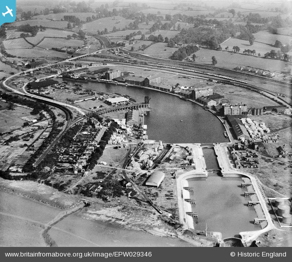
EPW029346 ENGLAND (1929). Sharpness Docks, Sharpness, 1929
© Copyright OpenStreetMap contributors and licensed by the OpenStreetMap Foundation. 2026. Cartography is licensed as CC BY-SA.
Nearby Images (9)
EPW029346

EPW029343

EAW012141

EAW012138

EPW005401

EPW005400

EAW006849

EAW012140

EPW037752

Details
| Title | [EPW029346] Sharpness Docks, Sharpness, 1929 |
| Reference | EPW029346 |
| Date | September-1929 |
| Link | |
| Place name | SHARPNESS |
| Parish | HINTON |
| District | |
| Country | ENGLAND |
| Easting / Northing | 367093, 202426 |
| Longitude / Latitude | -2.4764122710681, 51.719135136076 |
| National Grid Reference | SO671024 |
Pins

MB |
Monday 22nd of August 2016 02:36:05 PM | |
|
Louis |
Wednesday 12th of November 2014 08:34:17 PM | |

Maurice |
Thursday 11th of April 2013 11:23:05 AM | |
|
Maurice |
Thursday 11th of April 2013 11:21:22 AM | |
|
Maurice |
Thursday 11th of April 2013 11:20:19 AM | |
|
Maurice |
Thursday 11th of April 2013 09:03:26 AM | |
|
Maurice |
Thursday 11th of April 2013 08:42:47 AM | |
|
hoppy |
Wednesday 10th of April 2013 05:10:18 AM | |
|
hoppy |
Wednesday 10th of April 2013 05:08:07 AM | |
I think the line that ran to Lydney via the Severn Bridge is the one that runs from the station. These are just sidings. |
Maurice |
Thursday 11th of April 2013 11:19:29 AM |
|
hoppy |
Wednesday 10th of April 2013 05:03:34 AM |