
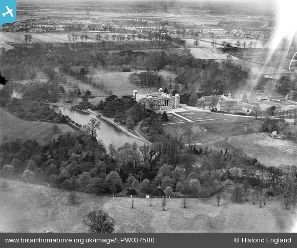
EPW037580 ENGLAND (1932). Osterley Park, Osterley, 1932
© Copyright OpenStreetMap contributors and licensed by the OpenStreetMap Foundation. 2026. Cartography is licensed as CC BY-SA.
Nearby Images (8)
EPW037580

EPW017386

EPW037579

EPW037578

EPW060615

EPW057962

EPW023236

EPW057963

Details
| Title | [EPW037580] Osterley Park, Osterley, 1932 |
| Reference | EPW037580 |
| Date | April-1932 |
| Link | |
| Place name | OSTERLEY |
| Parish | |
| District | |
| Country | ENGLAND |
| Easting / Northing | 514581, 178005 |
| Longitude / Latitude | -0.34947191028597, 51.48888461868 |
| National Grid Reference | TQ146780 |
Pins

longshot |
Monday 17th of June 2013 08:10:33 PM |