
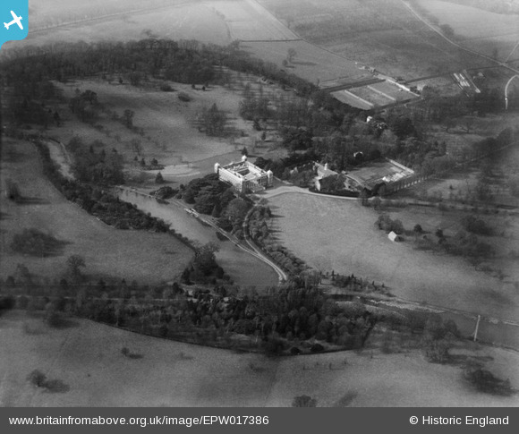
EPW017386 ENGLAND (1927). Osterley Park and grounds, Osterley Park, 1927
© Copyright OpenStreetMap contributors and licensed by the OpenStreetMap Foundation. 2026. Cartography is licensed as CC BY-SA.
Nearby Images (8)
EPW017386

EPW037580

EPW037579

EPW060615

EPW037578

EPW057962

EPW023236

EPW057963

Details
| Title | [EPW017386] Osterley Park and grounds, Osterley Park, 1927 |
| Reference | EPW017386 |
| Date | March-1927 |
| Link | |
| Place name | OSTERLEY PARK |
| Parish | |
| District | |
| Country | ENGLAND |
| Easting / Northing | 514577, 178018 |
| Longitude / Latitude | -0.34952528387407, 51.489002283629 |
| National Grid Reference | TQ146780 |
Pins
Be the first to add a comment to this image!