
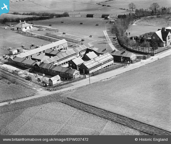
EPW037472 ENGLAND. The Poultry Pathological Research Laboratories, Goring, 1932
© Copyright OpenStreetMap contributors and licensed by the OpenStreetMap Foundation. 2026. Cartography is licensed as CC BY-SA.
Nearby Images (9)
EPW037472

EPW037476

EPW037474

EPW037473

EPW037477

EPW037475

EPW037478

EPW037480

EPW037479

Details
| Title | [EPW037472] The Poultry Pathological Research Laboratories, Goring, 1932 |
| Reference | EPW037472 |
| Date | |
| Link | |
| Place name | GORING |
| Parish | GORING |
| District | |
| Country | ENGLAND |
| Easting / Northing | 461109, 182084 |
| Longitude / Latitude | -1.1188828583466, 51.533870811692 |
| National Grid Reference | SU611821 |
Pins

Class31 |
Thursday 13th of December 2012 12:48:27 PM |
User Comment Contributions
Thanks for labelling up the Poultry Lab images. We'll pick them all up to add the location data and get the detail posted here in due course. Yours, Katy Britain from Above Cataloguing Team Leader |
Katy Whitaker |
Wednesday 2nd of January 2013 03:29:11 PM |