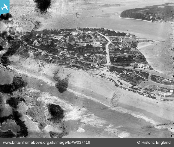
EPW037419 ENGLAND (1932). Sandbanks, Poole, 1932. This image has been produced from a damaged negative.
    © Copyright OpenStreetMap contributors and licensed by the OpenStreetMap Foundation. 2025. Cartography is licensed as CC BY-SA.
  
Details
| Title | [EPW037419] Sandbanks, Poole, 1932. This image has been produced from a damaged negative. | 
| Reference | EPW037419 | 
| Date | May-1932 | 
| Link | |
| Place name | POOLE | 
| Parish | |
| District | |
| Country | ENGLAND | 
| Easting / Northing | 404318, 87537 | 
| Longitude / Latitude | -1.9388680020002, 50.686892218466 | 
| National Grid Reference | SZ043875 | 
 
             
  ![[EPW037419] Sandbanks, Poole, 1932. This image has been produced from a damaged negative.](http://britainfromabove.org.uk/sites/all/libraries/aerofilms-images/public/100x100/EPW/037/EPW037419.jpg) 
  
                                          ![[EAW049053] Sandbanks and Poole Harbour, Sandbanks, from the east, 1953](http://britainfromabove.org.uk/sites/all/libraries/aerofilms-images/public/100x100/EAW/049/EAW049053.jpg) 
 ![[EPW041054] The Pavilion and Recreation Ground, Sandbanks, 1933](http://britainfromabove.org.uk/sites/all/libraries/aerofilms-images/public/100x100/EPW/041/EPW041054.jpg) 
 ![[EAW019957] Sandbanks, Brownsea Island and Poole Harbour, Sandbanks, from the south-east, 1948. This image has been produced from a print.](http://britainfromabove.org.uk/sites/all/libraries/aerofilms-images/public/100x100/EAW/019/EAW019957.jpg) 
  This property is still here 8/3/2014
 This property is still here 8/3/2014