
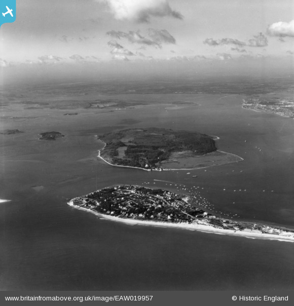
EAW019957 ENGLAND (1948). Sandbanks, Brownsea Island and Poole Harbour, Sandbanks, from the south-east, 1948. This image has been produced from a print.
© Copyright OpenStreetMap contributors and licensed by the OpenStreetMap Foundation. 2026. Cartography is licensed as CC BY-SA.
Nearby Images (4)
EAW019957

EAW049053

EAW010969

EPW037419

Details
| Title | [EAW019957] Sandbanks, Brownsea Island and Poole Harbour, Sandbanks, from the south-east, 1948. This image has been produced from a print. |
| Reference | EAW019957 |
| Date | 19-October-1948 |
| Link | |
| Place name | SANDBANKS |
| Parish | |
| District | |
| Country | ENGLAND |
| Easting / Northing | 404133, 87315 |
| Longitude / Latitude | -1.9414896174906, 50.684896948457 |
| National Grid Reference | SZ041873 |
Pins

redmist |
Monday 25th of March 2024 08:50:57 PM |