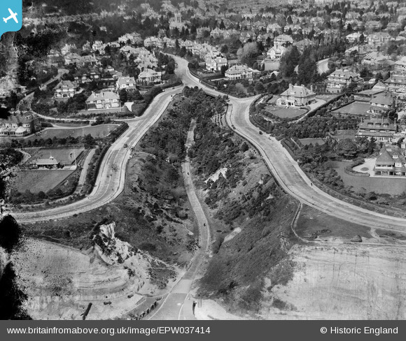
EPW037414 ENGLAND (1932). Housing surrounding West Overcliff Drive and the Middle Chine, Bournemouth, 1932
© Copyright OpenStreetMap contributors and licensed by the OpenStreetMap Foundation. 2025. Cartography is licensed as CC BY-SA.
Nearby Images (7)
Details
| Title | [EPW037414] Housing surrounding West Overcliff Drive and the Middle Chine, Bournemouth, 1932 |
| Reference | EPW037414 |
| Date | April-1932 |
| Link | |
| Place name | BOURNEMOUTH |
| Parish | |
| District | |
| Country | ENGLAND |
| Easting / Northing | 407600, 90444 |
| Longitude / Latitude | -1.8923433805639, 50.713003348041 |
| National Grid Reference | SZ076904 |
Pins

Veejay |
Monday 20th of January 2025 05:18:14 PM | |

Veejay |
Monday 20th of January 2025 05:16:32 PM | |

Veejay |
Monday 20th of January 2025 05:06:47 PM | |

Veejay |
Monday 20th of January 2025 04:35:48 PM | |

Gary |
Sunday 7th of November 2021 08:05:49 AM | |

Class31 |
Sunday 26th of January 2014 10:44:48 AM |
User Comment Contributions
Beach huts at Middle Chine 25/01/2014 |

Class31 |
Sunday 26th of January 2014 10:47:24 AM |


![[EPW037414] Housing surrounding West Overcliff Drive and the Middle Chine, Bournemouth, 1932](http://britainfromabove.org.uk/sites/all/libraries/aerofilms-images/public/100x100/EPW/037/EPW037414.jpg)
![[EPW018166] West Overcliff Drive, West Cliff, 1927. This image has been produced from a print.](http://britainfromabove.org.uk/sites/all/libraries/aerofilms-images/public/100x100/EPW/018/EPW018166.jpg)
![[EPR000667] Argyle Gardens and environs, West Cliff, 1935](http://britainfromabove.org.uk/sites/all/libraries/aerofilms-images/public/100x100/EPR/000/EPR000667.jpg)
![[EPW013555] Middle Chine, Bournemouth, 1925](http://britainfromabove.org.uk/sites/all/libraries/aerofilms-images/public/100x100/EPW/013/EPW013555.jpg)
![[EAW049055] The residential area surrounding West Overcliff Drive and environs, West Cliff, from the south-east, 1953](http://britainfromabove.org.uk/sites/all/libraries/aerofilms-images/public/100x100/EAW/049/EAW049055.jpg)
![[EPW013554] Alum Chine, Bournemouth, 1925](http://britainfromabove.org.uk/sites/all/libraries/aerofilms-images/public/100x100/EPW/013/EPW013554.jpg)
![[EPW000265] Middle Chine, Bournemouth, from the south-east, 1920](http://britainfromabove.org.uk/sites/all/libraries/aerofilms-images/public/100x100/EPW/000/EPW000265.jpg)