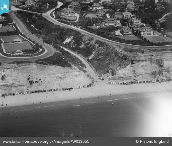
EPW013555 ENGLAND (1925). Middle Chine, Bournemouth, 1925
© Copyright OpenStreetMap contributors and licensed by the OpenStreetMap Foundation. 2025. Cartography is licensed as CC BY-SA.
Nearby Images (6)
Details
| Title | [EPW013555] Middle Chine, Bournemouth, 1925 |
| Reference | EPW013555 |
| Date | June-1925 |
| Link | |
| Place name | BOURNEMOUTH |
| Parish | |
| District | |
| Country | ENGLAND |
| Easting / Northing | 407666, 90363 |
| Longitude / Latitude | -1.8914101526927, 50.712273990999 |
| National Grid Reference | SZ077904 |
Pins
Be the first to add a comment to this image!
User Comment Contributions
Middle Chine 25/01/2014 |

Class31 |
Monday 27th of January 2014 02:30:33 PM |


![[EPW013555] Middle Chine, Bournemouth, 1925](http://britainfromabove.org.uk/sites/all/libraries/aerofilms-images/public/100x100/EPW/013/EPW013555.jpg)
![[EAW049055] The residential area surrounding West Overcliff Drive and environs, West Cliff, from the south-east, 1953](http://britainfromabove.org.uk/sites/all/libraries/aerofilms-images/public/100x100/EAW/049/EAW049055.jpg)
![[EPW018166] West Overcliff Drive, West Cliff, 1927. This image has been produced from a print.](http://britainfromabove.org.uk/sites/all/libraries/aerofilms-images/public/100x100/EPW/018/EPW018166.jpg)
![[EPW037414] Housing surrounding West Overcliff Drive and the Middle Chine, Bournemouth, 1932](http://britainfromabove.org.uk/sites/all/libraries/aerofilms-images/public/100x100/EPW/037/EPW037414.jpg)
![[EPR000667] Argyle Gardens and environs, West Cliff, 1935](http://britainfromabove.org.uk/sites/all/libraries/aerofilms-images/public/100x100/EPR/000/EPR000667.jpg)
![[EPW018165] Beach huts by the bowling green, West Cliff, 1927. This image has been produced from a copy-negative.](http://britainfromabove.org.uk/sites/all/libraries/aerofilms-images/public/100x100/EPW/018/EPW018165.jpg)