
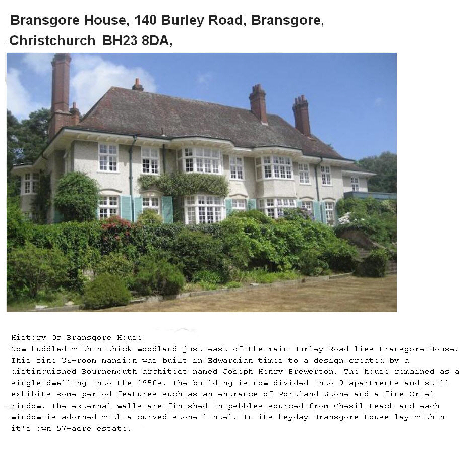
EPW037373 ENGLAND (1932). Bransgore House, Bransgore, 1932

© Copyright OpenStreetMap contributors and licensed by the OpenStreetMap Foundation. 2026. Cartography is licensed as CC BY-SA.
Nearby Images (9)
EPW037373

EPW037369

EPW037374

EPW037370

EPW037376

EPW037368

EPW037375

EPW037372

EPW037367

Details
| Title | [EPW037373] Bransgore House, Bransgore, 1932 |
| Reference | EPW037373 |
| Date | 12-April-1932 |
| Link | |
| Place name | BRANSGORE |
| Parish | BRANSGORE |
| District | |
| Country | ENGLAND |
| Easting / Northing | 419327, 98190 |
| Longitude / Latitude | -1.7258212019102, 50.782395774017 |
| National Grid Reference | SZ193982 |
Pins

changie2012 |
Sunday 7th of April 2013 04:10:48 PM |
User Comment Contributions
Thanks for the help with this image and the others in the group of the site. I shall post the same message to all of them (just to be clear that we have picked up on the information). We'll update the catalogue record, and post the updated details here in due course. Yours, Katy Britain from Above Cataloguing Team Leader |
Katy Whitaker |
Friday 8th of March 2013 03:10:43 PM |
This is Bransgore House near Christchurch in the New Forest |
RichardW |
Thursday 3rd of January 2013 04:39:37 PM |
Well Done RichardW for getting this series of photos. |

Class31 |
Thursday 3rd of January 2013 04:39:37 PM |
see also EPW037368,9,70,71,2,3,4,5 & 6. |
BigglesH |
Sunday 16th of December 2012 04:35:30 PM |