
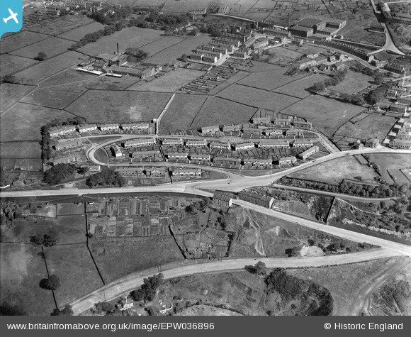
EPW036896 ENGLAND (1931). Bracewell Drive, Halifax, 1931
© Copyright OpenStreetMap contributors and licensed by the OpenStreetMap Foundation. 2025. Cartography is licensed as CC BY-SA.
Nearby Images (3)
EPW036896

EPW036897

EPW036895

Details
| Title | [EPW036896] Bracewell Drive, Halifax, 1931 |
| Reference | EPW036896 |
| Date | September-1931 |
| Link | |
| Place name | HALIFAX |
| Parish | |
| District | |
| Country | ENGLAND |
| Easting / Northing | 407957, 426466 |
| Longitude / Latitude | -1.8793660350694, 53.734301752207 |
| National Grid Reference | SE080265 |
