
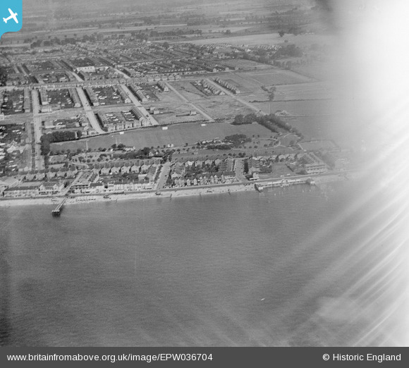
EPW036704 ENGLAND (1931). The seafront, housing surrounding Shaftesbury Avenue and Southchurch Hall Park, Southend-on-Sea, 1931. This image has been affected by flare.
© Copyright OpenStreetMap contributors and licensed by the OpenStreetMap Foundation. 2026. Cartography is licensed as CC BY-SA.
Nearby Images (9)
EPW036704

EPW036741

EPW024883

EPW036755

EPW036727

EPW040979

EPW036754

EPW024889

EPW024871

Details
| Title | [EPW036704] The seafront, housing surrounding Shaftesbury Avenue and Southchurch Hall Park, Southend-on-Sea, 1931. This image has been affected by flare. |
| Reference | EPW036704 |
| Date | September-1931 |
| Link | |
| Place name | SOUTHEND-ON-SEA |
| Parish | |
| District | |
| Country | ENGLAND |
| Easting / Northing | 589854, 184785 |
| Longitude / Latitude | 0.73741259376872, 51.529526422462 |
| National Grid Reference | TQ899848 |
Pins

Sara |
Thursday 18th of January 2024 07:42:41 PM | |
|
Sara |
Thursday 18th of January 2024 07:40:59 PM | |
|
Sara |
Thursday 18th of January 2024 07:40:07 PM | |
|
Sara |
Thursday 18th of January 2024 07:39:16 PM | |
|
Sara |
Thursday 18th of January 2024 07:37:04 PM | |
|
Sara |
Thursday 18th of January 2024 07:36:05 PM | |
|
bargee1937 |
Saturday 25th of April 2015 02:04:48 PM | |
|
bargee1937 |
Saturday 25th of April 2015 02:03:00 PM | |
|
bargee1937 |
Saturday 25th of April 2015 02:01:43 PM |