
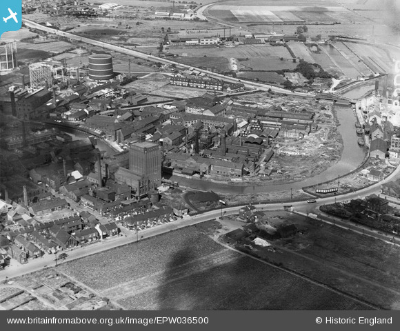
EPW036500 ENGLAND (1931). Isis Oil Mills and the River Hull, Kingston upon Hull, 1931
© Copyright OpenStreetMap contributors and licensed by the OpenStreetMap Foundation. 2026. Cartography is licensed as CC BY-SA.
Nearby Images (4)
EPW036500

EPW036509

EPW034656

EPW034650

Details
| Title | [EPW036500] Isis Oil Mills and the River Hull, Kingston upon Hull, 1931 |
| Reference | EPW036500 |
| Date | August-1931 |
| Link | |
| Place name | KINGSTON UPON HULL |
| Parish | |
| District | |
| Country | ENGLAND |
| Easting / Northing | 510239, 431121 |
| Longitude / Latitude | -0.32742427388597, 53.764538781644 |
| National Grid Reference | TA102311 |
Pins

John Wass |
Tuesday 23rd of September 2014 03:16:16 PM | |
|
John Wass |
Tuesday 23rd of September 2014 03:14:25 PM | |
|
John Wass |
Tuesday 19th of August 2014 03:33:27 PM | |
|
wingas |
Monday 30th of December 2013 07:19:56 PM |