
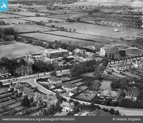
EPW036400 ENGLAND (1931). The City of Hull Municipal Training College, Kingston upon Hull, 1931
© Copyright OpenStreetMap contributors and licensed by the OpenStreetMap Foundation. 2025. Cartography is licensed as CC BY-SA.
Nearby Images (5)
EPW036400

EPW036513

EPW036403

EPW036541

EPW036402

Details
| Title | [EPW036400] The City of Hull Municipal Training College, Kingston upon Hull, 1931 |
| Reference | EPW036400 |
| Date | August-1931 |
| Link | |
| Place name | KINGSTON UPON HULL |
| Parish | |
| District | |
| Country | ENGLAND |
| Easting / Northing | 507526, 431620 |
| Longitude / Latitude | -0.36839415995317, 53.769589589015 |
| National Grid Reference | TA075316 |
Pins

MB |
Saturday 2nd of March 2013 11:21:08 PM | |
|
MB |
Saturday 2nd of March 2013 11:20:46 PM | |
|
MB |
Saturday 2nd of March 2013 11:18:23 PM | |
|
MB |
Saturday 2nd of March 2013 11:16:44 PM | |
|
MB |
Saturday 2nd of March 2013 11:15:29 PM | |
|
MB |
Saturday 2nd of March 2013 11:14:57 PM | |
|
MB |
Saturday 2nd of March 2013 11:13:45 PM | |
|
MB |
Saturday 2nd of March 2013 11:12:51 PM | |
|
MB |
Saturday 2nd of March 2013 11:12:28 PM |