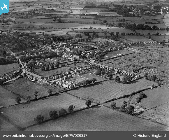
EPW036317 ENGLAND (1931). Calverton End and environs, Stony Stratford, 1931
© Copyright OpenStreetMap contributors and licensed by the OpenStreetMap Foundation. 2026. Cartography is licensed as CC BY-SA.
Details
| Title | [EPW036317] Calverton End and environs, Stony Stratford, 1931 |
| Reference | EPW036317 |
| Date | August-1931 |
| Link | |
| Place name | STONY STRATFORD |
| Parish | STONY STRATFORD |
| District | |
| Country | ENGLAND |
| Easting / Northing | 479128, 240058 |
| Longitude / Latitude | -0.84589099453342, 52.052833283058 |
| National Grid Reference | SP791401 |
Pins

Whtrz |
Wednesday 31st of May 2023 03:03:59 PM | |

melgibbs |
Tuesday 6th of May 2014 04:43:27 PM | |

melgibbs |
Thursday 1st of May 2014 06:44:08 PM | |

melgibbs |
Thursday 1st of May 2014 06:43:44 PM |


![[EPW036317] Calverton End and environs, Stony Stratford, 1931](http://britainfromabove.org.uk/sites/all/libraries/aerofilms-images/public/100x100/EPW/036/EPW036317.jpg)
![[EAW009509] The course of Watling Street Roman Road passing through the town, Stony Stratford, 1947](http://britainfromabove.org.uk/sites/all/libraries/aerofilms-images/public/100x100/EAW/009/EAW009509.jpg)
![[EPW036318] Calverton End, Stony Stratford, 1931](http://britainfromabove.org.uk/sites/all/libraries/aerofilms-images/public/100x100/EPW/036/EPW036318.jpg)
![[EPW036314] Calverton End and environs, Stony Stratford, 1931](http://britainfromabove.org.uk/sites/all/libraries/aerofilms-images/public/100x100/EPW/036/EPW036314.jpg)
