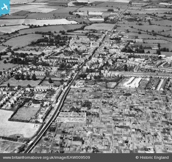
EAW009509 ENGLAND (1947). The course of Watling Street Roman Road passing through the town, Stony Stratford, 1947
© Copyright OpenStreetMap contributors and licensed by the OpenStreetMap Foundation. 2026. Cartography is licensed as CC BY-SA.
Nearby Images (5)
Details
| Title | [EAW009509] The course of Watling Street Roman Road passing through the town, Stony Stratford, 1947 |
| Reference | EAW009509 |
| Date | 19-August-1947 |
| Link | |
| Place name | STONY STRATFORD |
| Parish | STONY STRATFORD |
| District | |
| Country | ENGLAND |
| Easting / Northing | 479084, 240215 |
| Longitude / Latitude | -0.84649625713861, 52.054250969299 |
| National Grid Reference | SP791402 |
Pins

Whtrz |
Saturday 16th of December 2023 10:08:18 PM | |

Steve_R |
Sunday 22nd of December 2019 05:26:13 PM | |

Steve_R |
Sunday 22nd of December 2019 05:22:47 PM | |

melgibbs |
Saturday 5th of April 2014 05:58:00 PM |


![[EAW009509] The course of Watling Street Roman Road passing through the town, Stony Stratford, 1947](http://britainfromabove.org.uk/sites/all/libraries/aerofilms-images/public/100x100/EAW/009/EAW009509.jpg)
![[EPW036318] Calverton End, Stony Stratford, 1931](http://britainfromabove.org.uk/sites/all/libraries/aerofilms-images/public/100x100/EPW/036/EPW036318.jpg)
![[EPW036314] Calverton End and environs, Stony Stratford, 1931](http://britainfromabove.org.uk/sites/all/libraries/aerofilms-images/public/100x100/EPW/036/EPW036314.jpg)
![[EPW036317] Calverton End and environs, Stony Stratford, 1931](http://britainfromabove.org.uk/sites/all/libraries/aerofilms-images/public/100x100/EPW/036/EPW036317.jpg)
![[EPW022485] The town, Stony Stratford, 1928](http://britainfromabove.org.uk/sites/all/libraries/aerofilms-images/public/100x100/EPW/022/EPW022485.jpg)