
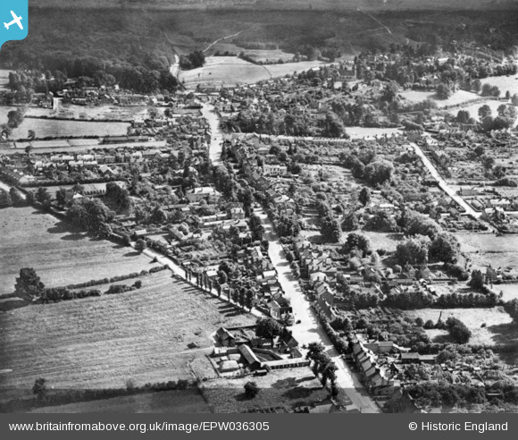
EPW036305 ENGLAND (1931). The town, Woburn Sands, 1931. This image has been produced from a copy-negative.
© Copyright OpenStreetMap contributors and licensed by the OpenStreetMap Foundation. 2025. Cartography is licensed as CC BY-SA.
Nearby Images (4)
EPW036305

EPW036292

EPW036288

EPW036290

Details
| Title | [EPW036305] The town, Woburn Sands, 1931. This image has been produced from a copy-negative. |
| Reference | EPW036305 |
| Date | August-1931 |
| Link | |
| Place name | WOBURN SANDS |
| Parish | WOBURN SANDS |
| District | |
| Country | ENGLAND |
| Easting / Northing | 492838, 235915 |
| Longitude / Latitude | -0.647106566239, 52.013463564347 |
| National Grid Reference | SP928359 |
Pins

SimonRae |
Friday 6th of March 2020 06:02:08 PM | |
|
SimonRae |
Wednesday 18th of April 2018 06:24:57 PM | |
|
RichardL |
Wednesday 18th of February 2015 10:25:44 AM |