
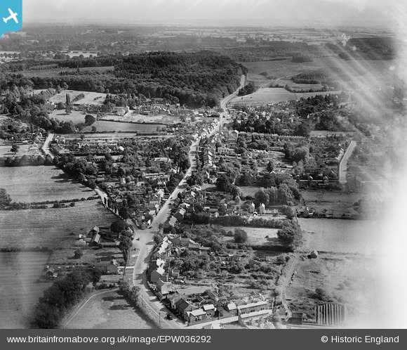
EPW036292 ENGLAND (1931). The town, Woburn Sands, from the north-west, 1931
© Copyright OpenStreetMap contributors and licensed by the OpenStreetMap Foundation. 2025. Cartography is licensed as CC BY-SA.
Nearby Images (3)
EPW036292

EPW036290

EPW036305

Details
| Title | [EPW036292] The town, Woburn Sands, from the north-west, 1931 |
| Reference | EPW036292 |
| Date | August-1931 |
| Link | |
| Place name | WOBURN SANDS |
| Parish | WOBURN SANDS |
| District | |
| Country | ENGLAND |
| Easting / Northing | 492714, 236039 |
| Longitude / Latitude | -0.64887944695265, 52.014598961402 |
| National Grid Reference | SP927360 |
Pins

SimonRae |
Friday 6th of March 2020 06:06:21 PM | |
|
SimonRae |
Wednesday 18th of April 2018 06:31:34 PM | |
|
SimonRae |
Wednesday 18th of April 2018 06:29:31 PM |