
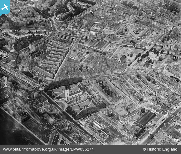
EPW036274 ENGLAND (1931). St Luke's Church, Sutton Model Dwellings and environs, Chelsea, 1931
© Copyright OpenStreetMap contributors and licensed by the OpenStreetMap Foundation. 2026. Cartography is licensed as CC BY-SA.
Nearby Images (13)
EPW036274

EPW035605

EPW035607

EPW036272

EPW035606

EPW036273

EPW036269

EPW036276

EPW036270

EPW036271

EPW036275

EPW060779

EPW043593

Details
| Title | [EPW036274] St Luke's Church, Sutton Model Dwellings and environs, Chelsea, 1931 |
| Reference | EPW036274 |
| Date | August-1931 |
| Link | |
| Place name | CHELSEA |
| Parish | |
| District | |
| Country | ENGLAND |
| Easting / Northing | 527267, 178447 |
| Longitude / Latitude | -0.16666753014336, 51.490143979995 |
| National Grid Reference | TQ273784 |
Pins

Alan McFaden |
Friday 18th of April 2014 10:20:22 PM |
