
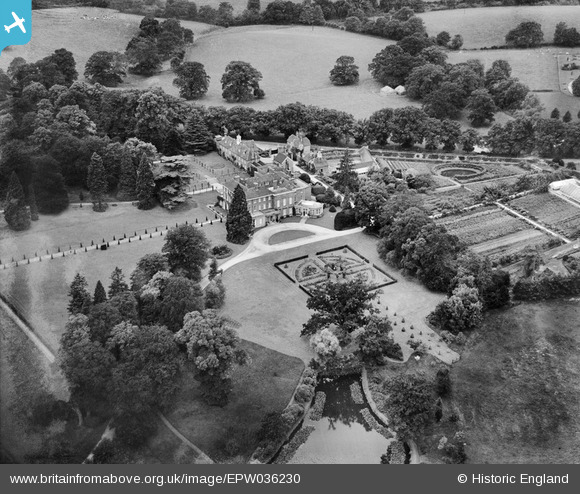
EPW036230 ENGLAND (1931). Woolhampton House and grounds, Woolhampton, 1931
© Copyright OpenStreetMap contributors and licensed by the OpenStreetMap Foundation. 2025. Cartography is licensed as CC BY-SA.
Nearby Images (4)
EPW036230

EPW036227

EPW036231

EPW036232

Details
| Title | [EPW036230] Woolhampton House and grounds, Woolhampton, 1931 |
| Reference | EPW036230 |
| Date | August-1931 |
| Link | |
| Place name | WOOLHAMPTON |
| Parish | WOOLHAMPTON |
| District | |
| Country | ENGLAND |
| Easting / Northing | 457710, 167518 |
| Longitude / Latitude | -1.1702657306218, 51.40325683028 |
| National Grid Reference | SU577675 |
Pins
Be the first to add a comment to this image!