
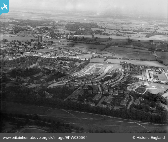
EPW035564 ENGLAND (1931). Housing surrounding Broadmead Road, Mayfair Gardens and environs, Woodford, from the west, 1931
© Copyright OpenStreetMap contributors and licensed by the OpenStreetMap Foundation. 2026. Cartography is licensed as CC BY-SA.
Nearby Images (2)
EPW035564

EPW035563

Details
| Title | [EPW035564] Housing surrounding Broadmead Road, Mayfair Gardens and environs, Woodford, from the west, 1931 |
| Reference | EPW035564 |
| Date | June-1931 |
| Link | |
| Place name | WOODFORD |
| Parish | |
| District | |
| Country | ENGLAND |
| Easting / Northing | 540212, 191619 |
| Longitude / Latitude | 0.024941504574801, 51.605456342375 |
| National Grid Reference | TQ402916 |
Pins

Toby Clempson |
Sunday 1st of September 2024 06:13:13 AM | |
|
SimonMarkSmith |
Thursday 29th of December 2022 02:19:28 AM | |
|
Mikeya |
Tuesday 30th of June 2020 08:05:23 PM |