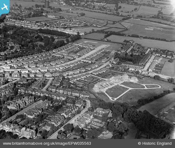
EPW035563 ENGLAND (1931). Housing surrounding Broadmead Road, Mayfair Gardens and environs, Woodford, 1931
© Copyright OpenStreetMap contributors and licensed by the OpenStreetMap Foundation. 2026. Cartography is licensed as CC BY-SA.
Details
| Title | [EPW035563] Housing surrounding Broadmead Road, Mayfair Gardens and environs, Woodford, 1931 |
| Reference | EPW035563 |
| Date | June-1931 |
| Link | |
| Place name | WOODFORD |
| Parish | |
| District | |
| Country | ENGLAND |
| Easting / Northing | 540423, 191465 |
| Longitude / Latitude | 0.027925033055843, 51.604019804455 |
| National Grid Reference | TQ404915 |
Pins

Mikeya |
Tuesday 30th of June 2020 07:59:05 PM | |

Mikeya |
Tuesday 30th of June 2020 07:58:22 PM | |

Mikeya |
Thursday 20th of April 2017 10:27:07 PM | |

Mikeya |
Thursday 20th of April 2017 10:19:52 PM | |

Mikeya |
Thursday 20th of April 2017 10:18:06 PM |


![[EPW035563] Housing surrounding Broadmead Road, Mayfair Gardens and environs, Woodford, 1931](http://britainfromabove.org.uk/sites/all/libraries/aerofilms-images/public/100x100/EPW/035/EPW035563.jpg)
![[EPW035562] Housing surrounding Broadmead Road and Mayfair Gardens, Woodford, 1931](http://britainfromabove.org.uk/sites/all/libraries/aerofilms-images/public/100x100/EPW/035/EPW035562.jpg)
![[EPW035564] Housing surrounding Broadmead Road, Mayfair Gardens and environs, Woodford, from the west, 1931](http://britainfromabove.org.uk/sites/all/libraries/aerofilms-images/public/100x100/EPW/035/EPW035564.jpg)