
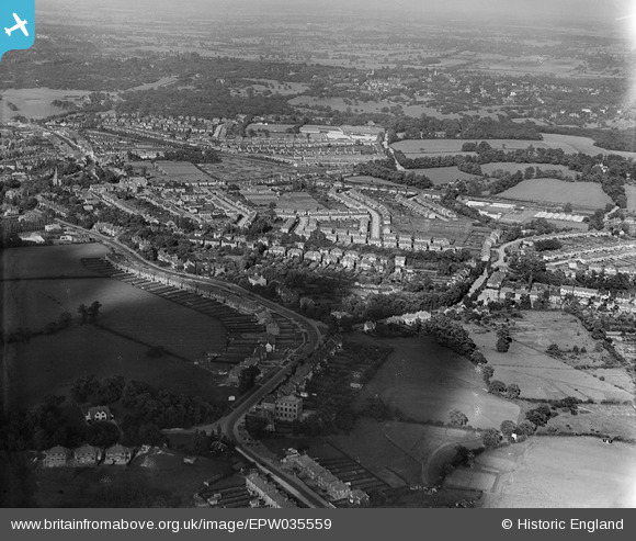
EPW035559 ENGLAND (1931). The Ridgeway and Ridgeway Park, Chingford, from the west, 1931
© Copyright OpenStreetMap contributors and licensed by the OpenStreetMap Foundation. 2026. Cartography is licensed as CC BY-SA.
Nearby Images (2)
EPW035559

EPW025368

Details
| Title | [EPW035559] The Ridgeway and Ridgeway Park, Chingford, from the west, 1931 |
| Reference | EPW035559 |
| Date | June-1931 |
| Link | |
| Place name | CHINGFORD |
| Parish | |
| District | |
| Country | ENGLAND |
| Easting / Northing | 538219, 193933 |
| Longitude / Latitude | -0.002909588495812, 51.626744739335 |
| National Grid Reference | TQ382939 |
