
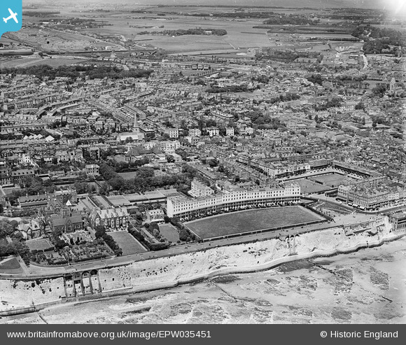
EPW035451 ENGLAND (1931). West Cliff, the Royal Crescent and the town, Ramsgate, 1931
© Copyright OpenStreetMap contributors and licensed by the OpenStreetMap Foundation. 2026. Cartography is licensed as CC BY-SA.
Nearby Images (7)
EPW035451

EPW000601

EPW000094

EAW009023

EPW000081

EPW013301

EAW009024

Details
| Title | [EPW035451] West Cliff, the Royal Crescent and the town, Ramsgate, 1931 |
| Reference | EPW035451 |
| Date | May-1931 |
| Link | |
| Place name | RAMSGATE |
| Parish | RAMSGATE |
| District | |
| Country | ENGLAND |
| Easting / Northing | 637776, 164563 |
| Longitude / Latitude | 1.4136152621838, 51.329862016908 |
| National Grid Reference | TR378646 |
Pins

Tara01 |
Wednesday 7th of May 2014 10:06:51 AM | |
|
Tara01 |
Wednesday 7th of May 2014 10:06:26 AM | |
|
Tara01 |
Wednesday 7th of May 2014 10:04:37 AM | |
|
Tara01 |
Wednesday 7th of May 2014 10:01:03 AM | |
|
Tara01 |
Wednesday 7th of May 2014 10:00:13 AM |