
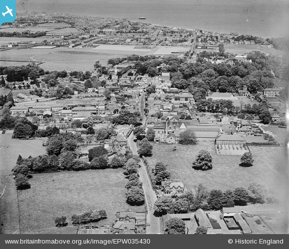
EPW035430 ENGLAND (1931). Dover Road, the Walmer Brewery and the town, Walmer, 1931
© Copyright OpenStreetMap contributors and licensed by the OpenStreetMap Foundation. 2026. Cartography is licensed as CC BY-SA.
Nearby Images (4)
EPW035430

EPW035428

EPW000387

EPW035429

Details
| Title | [EPW035430] Dover Road, the Walmer Brewery and the town, Walmer, 1931 |
| Reference | EPW035430 |
| Date | May-1931 |
| Link | |
| Place name | WALMER |
| Parish | WALMER |
| District | |
| Country | ENGLAND |
| Easting / Northing | 636775, 149978 |
| Longitude / Latitude | 1.3896157020649, 51.199348981058 |
| National Grid Reference | TR368500 |
Pins

Stu Giles |
Wednesday 27th of June 2018 07:51:50 PM | |
|
Stu Giles |
Wednesday 27th of June 2018 06:21:42 PM |