
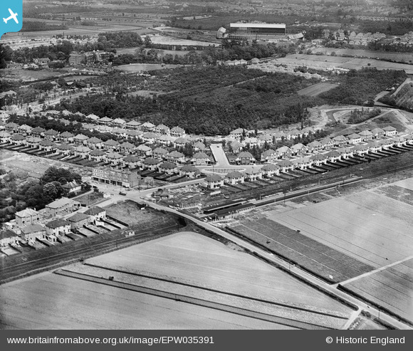
EPW035391 ENGLAND (1931). Housing surrounding Redway Drive, Whitton Railway Station and Twickenham Rugby Football Ground in the distance, Whitton, 1931
© Copyright OpenStreetMap contributors and licensed by the OpenStreetMap Foundation. 2026. Cartography is licensed as CC BY-SA.
Nearby Images (9)
EPW035391

EPW035384

EPW035383

EPW035380

EPW035386

EPW035388

EPW035381

EPW035382

EPW035390

Details
| Title | [EPW035391] Housing surrounding Redway Drive, Whitton Railway Station and Twickenham Rugby Football Ground in the distance, Whitton, 1931 |
| Reference | EPW035391 |
| Date | 27-May-1931 |
| Link | |
| Place name | WHITTON |
| Parish | |
| District | |
| Country | ENGLAND |
| Easting / Northing | 514306, 173639 |
| Longitude / Latitude | -0.35484392195096, 51.449695009591 |
| National Grid Reference | TQ143736 |
Pins

Class31 |
Monday 11th of March 2013 03:04:41 PM | |
|
Class31 |
Monday 11th of March 2013 03:01:09 PM | |
|
Class31 |
Monday 11th of March 2013 03:00:27 PM | |
|
Class31 |
Monday 11th of March 2013 02:59:30 PM | |
|
Class31 |
Monday 11th of March 2013 02:58:45 PM |