
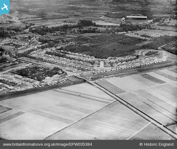
EPW035384 ENGLAND (1931). Housing at Whitton, Whitton Railway Station and Twickenham Rugby Football Ground in the distance, Whitton, 1931
© Copyright OpenStreetMap contributors and licensed by the OpenStreetMap Foundation. 2026. Cartography is licensed as CC BY-SA.
Nearby Images (10)
EPW035384

EPW035391

EPW035383

EPW035381

EPW035380

EPW035386

EPW035388

EPW035385

EPW035382

EPW035390

Details
| Title | [EPW035384] Housing at Whitton, Whitton Railway Station and Twickenham Rugby Football Ground in the distance, Whitton, 1931 |
| Reference | EPW035384 |
| Date | 27-May-1931 |
| Link | |
| Place name | WHITTON |
| Parish | |
| District | |
| Country | ENGLAND |
| Easting / Northing | 514262, 173630 |
| Longitude / Latitude | -0.35547982129033, 51.449622991878 |
| National Grid Reference | TQ143736 |
Pins

mogden1 |
Saturday 7th of February 2026 02:31:52 PM | |
|
mogden1 |
Saturday 7th of February 2026 02:31:24 PM | |
|
jamspy |
Wednesday 12th of November 2014 11:00:45 PM | |

Maurice |
Saturday 25th of October 2014 06:16:48 AM | |
|
Isleworth1961 |
Monday 11th of February 2013 03:42:54 PM | |
|
Isleworth1961 |
Monday 11th of February 2013 03:42:11 PM |