
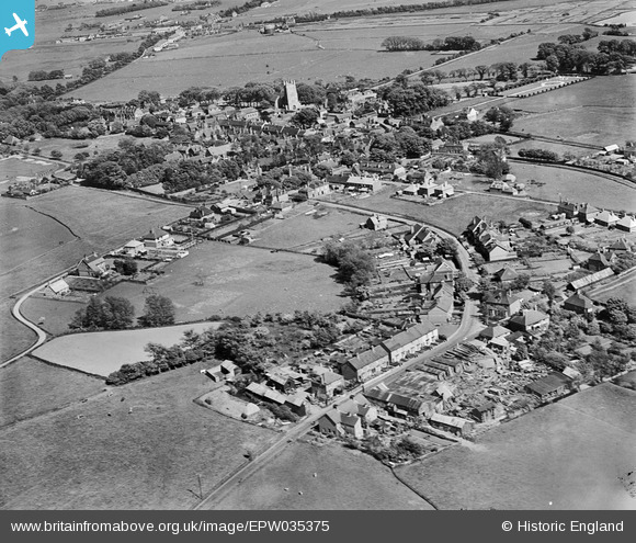
EPW035375 ENGLAND (1931). Sussex Road and the town, New Romney, 1931
© Copyright OpenStreetMap contributors and licensed by the OpenStreetMap Foundation. 2026. Cartography is licensed as CC BY-SA.
Nearby Images (2)
EPW035375

EPW035373

Details
| Title | [EPW035375] Sussex Road and the town, New Romney, 1931 |
| Reference | EPW035375 |
| Date | 25-May-1931 |
| Link | |
| Place name | NEW ROMNEY |
| Parish | NEW ROMNEY |
| District | |
| Country | ENGLAND |
| Easting / Northing | 606069, 124796 |
| Longitude / Latitude | 0.93633381999947, 50.9850853116 |
| National Grid Reference | TR061248 |
Pins

Bob Labrax |
Monday 16th of December 2024 02:13:40 PM | |
|
Bob Labrax |
Monday 16th of December 2024 02:12:09 PM | |
|
Bob Labrax |
Monday 16th of December 2024 02:10:35 PM |