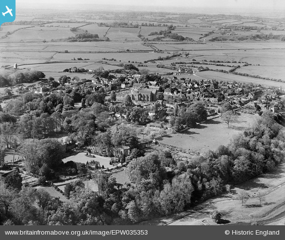
EPW035353 ENGLAND (1931). The town, Winchelsea, from the south-east, 1931
© Copyright OpenStreetMap contributors and licensed by the OpenStreetMap Foundation. 2025. Cartography is licensed as CC BY-SA.
Nearby Images (6)
Details
| Title | [EPW035353] The town, Winchelsea, from the south-east, 1931 |
| Reference | EPW035353 |
| Date | 25-May-1931 |
| Link | |
| Place name | WINCHELSEA |
| Parish | ICKLESHAM |
| District | |
| Country | ENGLAND |
| Easting / Northing | 590613, 117107 |
| Longitude / Latitude | 0.71234566451134, 50.921338792607 |
| National Grid Reference | TQ906171 |
Pins
Be the first to add a comment to this image!


![[EPW035353] The town, Winchelsea, from the south-east, 1931](http://britainfromabove.org.uk/sites/all/libraries/aerofilms-images/public/100x100/EPW/035/EPW035353.jpg)
![[EPW026106] The Friars and the remains of Winchelsea Friary, Winchelsea, 1929](http://britainfromabove.org.uk/sites/all/libraries/aerofilms-images/public/100x100/EPW/026/EPW026106.jpg)
![[EPW000695] Wincheslea, from the south-east, 1920](http://britainfromabove.org.uk/sites/all/libraries/aerofilms-images/public/100x100/EPW/000/EPW000695.jpg)
![[EPW026107] The Friars, the remains of Winchelsea Friary and The Rookery, Winchelsea, 1929](http://britainfromabove.org.uk/sites/all/libraries/aerofilms-images/public/100x100/EPW/026/EPW026107.jpg)
![[EPW026112] St Thomas's Church and graveyard, Winchelsea, 1929](http://britainfromabove.org.uk/sites/all/libraries/aerofilms-images/public/100x100/EPW/026/EPW026112.jpg)
![[EPW026108] St Thomas's Church and Court Hall, Winchelsea, 1929](http://britainfromabove.org.uk/sites/all/libraries/aerofilms-images/public/100x100/EPW/026/EPW026108.jpg)