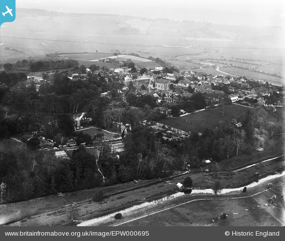
EPW000695 ENGLAND (1920). Wincheslea, from the south-east, 1920
© Copyright OpenStreetMap contributors and licensed by the OpenStreetMap Foundation. 2025. Cartography is licensed as CC BY-SA.
Details
| Title | [EPW000695] Wincheslea, from the south-east, 1920 |
| Reference | EPW000695 |
| Date | May-1920 |
| Link | |
| Place name | WINCHELSEA |
| Parish | ICKLESHAM |
| District | |
| Country | ENGLAND |
| Easting / Northing | 590640, 117045 |
| Longitude / Latitude | 0.71269699281206, 50.920772906711 |
| National Grid Reference | TQ906170 |


![[EPW000695] Wincheslea, from the south-east, 1920](http://britainfromabove.org.uk/sites/all/libraries/aerofilms-images/public/100x100/EPW/000/EPW000695.jpg)
![[EPW035353] The town, Winchelsea, from the south-east, 1931](http://britainfromabove.org.uk/sites/all/libraries/aerofilms-images/public/100x100/EPW/035/EPW035353.jpg)
![[EPW026106] The Friars and the remains of Winchelsea Friary, Winchelsea, 1929](http://britainfromabove.org.uk/sites/all/libraries/aerofilms-images/public/100x100/EPW/026/EPW026106.jpg)
![[EPW026107] The Friars, the remains of Winchelsea Friary and The Rookery, Winchelsea, 1929](http://britainfromabove.org.uk/sites/all/libraries/aerofilms-images/public/100x100/EPW/026/EPW026107.jpg)

