
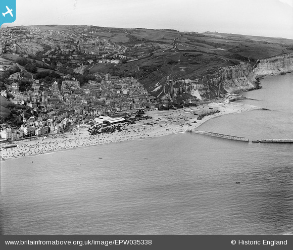
EPW035338 ENGLAND (1931). Old Town and environs, Hastings, from the south-west, 1931
© Copyright OpenStreetMap contributors and licensed by the OpenStreetMap Foundation. 2026. Cartography is licensed as CC BY-SA.
Nearby Images (8)
EPW035338

EPW000675

EPW042837

EAW002401

EAW006617

EAW022978

EPW026195

EPW039368

Details
| Title | [EPW035338] Old Town and environs, Hastings, from the south-west, 1931 |
| Reference | EPW035338 |
| Date | 25-May-1931 |
| Link | |
| Place name | HASTINGS |
| Parish | |
| District | |
| Country | ENGLAND |
| Easting / Northing | 582426, 109294 |
| Longitude / Latitude | 0.59207746247294, 50.853791888853 |
| National Grid Reference | TQ824093 |
Pins

Alan McFaden |
Tuesday 8th of July 2014 10:50:00 AM | |
|
Alan McFaden |
Wednesday 2nd of July 2014 01:48:13 PM | |
|
Alan McFaden |
Wednesday 2nd of July 2014 01:47:36 PM | |
|
Alan McFaden |
Wednesday 2nd of July 2014 01:46:33 PM | |
|
Alan McFaden |
Wednesday 2nd of July 2014 01:45:52 PM |


