
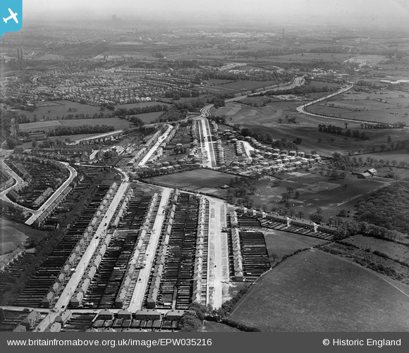
EPW035216 ENGLAND (1931). Sudbury Heights Avenue, Whitton Avenue and environs, Sudbury, from the north-west, 1931
© Copyright OpenStreetMap contributors and licensed by the OpenStreetMap Foundation. 2026. Cartography is licensed as CC BY-SA.
Nearby Images (3)
EPW035216

EPW061236

EPW035206

Details
| Title | [EPW035216] Sudbury Heights Avenue, Whitton Avenue and environs, Sudbury, from the north-west, 1931 |
| Reference | EPW035216 |
| Date | May-1931 |
| Link | |
| Place name | SUDBURY |
| Parish | |
| District | |
| Country | ENGLAND |
| Easting / Northing | 516397, 184953 |
| Longitude / Latitude | -0.32102907206443, 51.550966562357 |
| National Grid Reference | TQ164850 |
Pins

Graham |
Tuesday 11th of December 2012 10:20:31 PM | |
|
Graham |
Tuesday 11th of December 2012 10:19:21 PM | |
|
Graham |
Tuesday 11th of December 2012 10:18:10 PM | |
|
Graham |
Tuesday 11th of December 2012 10:16:32 PM | |
|
Graham |
Tuesday 11th of December 2012 10:15:46 PM | |
|
Graham |
Tuesday 11th of December 2012 10:14:08 PM | |
|
Graham |
Tuesday 11th of December 2012 10:13:36 PM | |
|
Graham |
Tuesday 11th of December 2012 10:13:03 PM | |
|
Graham |
Tuesday 11th of December 2012 10:12:17 PM | |
|
Graham |
Tuesday 11th of December 2012 10:11:44 PM |