
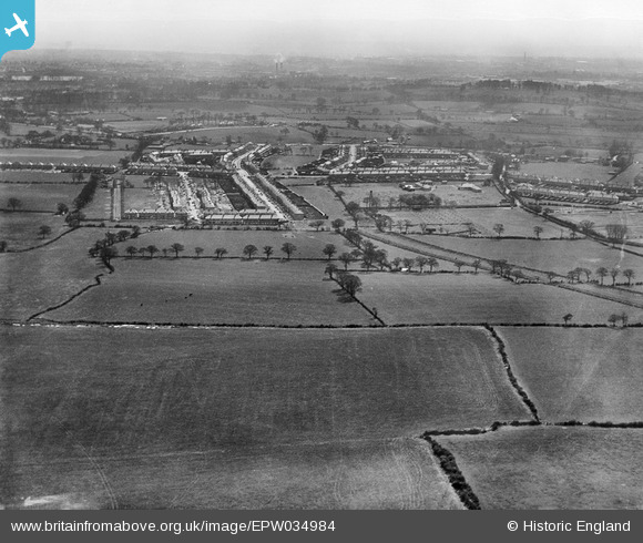
EPW034984 ENGLAND (1931). Housing development adjacent to Princes Avenue, Queensbury, from the north, 1931
© Copyright OpenStreetMap contributors and licensed by the OpenStreetMap Foundation. 2026. Cartography is licensed as CC BY-SA.
Nearby Images (12)
EPW034984

EPW034984
EPW032035

EPW032032

EPW025690

EPW026593

EPW034795

EPW032034

EPW032033

EPW025893

EPW035008

EPW035015

Details
| Title | [EPW034984] Housing development adjacent to Princes Avenue, Queensbury, from the north, 1931 |
| Reference | EPW034984 |
| Date | April-1931 |
| Link | |
| Place name | QUEENSBURY |
| Parish | |
| District | |
| Country | ENGLAND |
| Easting / Northing | 519023, 189925 |
| Longitude / Latitude | -0.28148352676348, 51.595108682838 |
| National Grid Reference | TQ190899 |
Pins

The Laird |
Tuesday 11th of October 2022 12:27:18 PM | |
|
The Laird |
Tuesday 11th of October 2022 12:24:59 PM | |
|
The Laird |
Tuesday 11th of October 2022 12:24:29 PM | |
|
The Laird |
Tuesday 11th of October 2022 12:15:28 PM | |
|
The Laird |
Tuesday 11th of October 2022 12:12:18 PM | |
|
The Laird |
Tuesday 11th of October 2022 11:46:15 AM | |

Class31 |
Saturday 30th of March 2013 08:49:10 PM | |
|
Class31 |
Saturday 30th of March 2013 08:48:52 PM | |
|
Class31 |
Saturday 30th of March 2013 08:48:22 PM |