
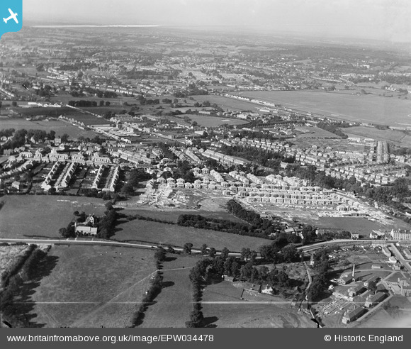
EPW034478 ENGLAND (1930). Housing under construction at Springfield Mount and environs, Kingsbury, from the south, 1930
© Copyright OpenStreetMap contributors and licensed by the OpenStreetMap Foundation. 2026. Cartography is licensed as CC BY-SA.
Nearby Images (11)
EPW034478

EPW034475

EPW029985

EPW030079

EPW029984

EPW030078

EPW034472

EPW029986

EPW034474

EPW029988

EPW029987

Details
| Title | [EPW034478] Housing under construction at Springfield Mount and environs, Kingsbury, from the south, 1930 |
| Reference | EPW034478 |
| Date | August-1930 |
| Link | |
| Place name | KINGSBURY |
| Parish | |
| District | |
| Country | ENGLAND |
| Easting / Northing | 521094, 188498 |
| Longitude / Latitude | -0.25208862151424, 51.581841083851 |
| National Grid Reference | TQ211885 |
Pins

The Laird |
Thursday 29th of March 2018 06:46:23 PM | |
|
Dank |
Thursday 24th of December 2015 11:45:57 AM | |

Class31 |
Thursday 13th of March 2014 01:09:17 PM | |
|
Class31 |
Thursday 13th of March 2014 12:38:17 PM | |
|
Class31 |
Thursday 13th of March 2014 12:37:13 PM | |
|
Class31 |
Thursday 13th of March 2014 12:36:22 PM | |
|
Class31 |
Thursday 13th of March 2014 12:29:25 PM |

