
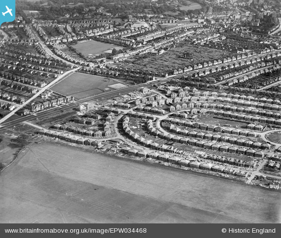
EPW034468 ENGLAND (1930). Housing under construction at Pennine Drive, Golders Green, 1930
© Copyright OpenStreetMap contributors and licensed by the OpenStreetMap Foundation. 2026. Cartography is licensed as CC BY-SA.
Nearby Images (10)
EPW034468

EPW052704

EPW034466

EPW034467

EPW034463

EPW034462

EPW034469

EPW034470

EPW038718

EPW034464

Details
| Title | [EPW034468] Housing under construction at Pennine Drive, Golders Green, 1930 |
| Reference | EPW034468 |
| Date | August-1930 |
| Link | |
| Place name | GOLDERS GREEN |
| Parish | |
| District | |
| Country | ENGLAND |
| Easting / Northing | 524203, 186987 |
| Longitude / Latitude | -0.20776998429687, 51.567583535345 |
| National Grid Reference | TQ242870 |
Pins
Be the first to add a comment to this image!