
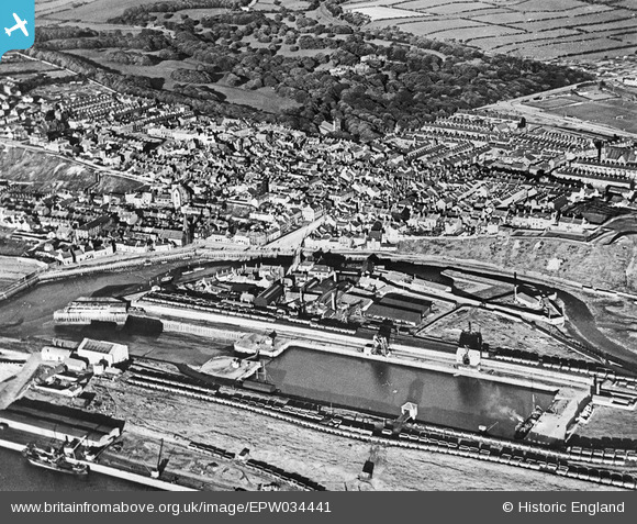
EPW034441 ENGLAND (1930). The docks and town, Maryport, 1930
© Copyright OpenStreetMap contributors and licensed by the OpenStreetMap Foundation. 2026. Cartography is licensed as CC BY-SA.
Nearby Images (2)
EPW034441

EPW034439

Details
| Title | [EPW034441] The docks and town, Maryport, 1930 |
| Reference | EPW034441 |
| Date | August-1930 |
| Link | |
| Place name | MARYPORT |
| Parish | MARYPORT |
| District | |
| Country | ENGLAND |
| Easting / Northing | 303415, 536526 |
| Longitude / Latitude | -3.4994524376027, 54.714349268001 |
| National Grid Reference | NY034365 |
Pins

oozthajorn |
Sunday 7th of January 2024 09:23:17 PM | |
|
RichardG |
Thursday 28th of June 2018 04:46:56 PM |