
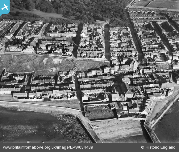
EPW034439 ENGLAND (1930). The town at North Harbour, Maryport, 1930
© Copyright OpenStreetMap contributors and licensed by the OpenStreetMap Foundation. 2026. Cartography is licensed as CC BY-SA.
Nearby Images (2)
EPW034439

EPW034441

Details
| Title | [EPW034439] The town at North Harbour, Maryport, 1930 |
| Reference | EPW034439 |
| Date | August-1930 |
| Link | |
| Place name | MARYPORT |
| Parish | MARYPORT |
| District | |
| Country | ENGLAND |
| Easting / Northing | 303511, 536760 |
| Longitude / Latitude | -3.4980401545895, 54.71647007736 |
| National Grid Reference | NY035368 |
Pins
Be the first to add a comment to this image!