
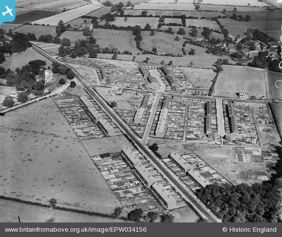
EPW034156 ENGLAND (1930). Housing along Wakefield Road and Astley Lane, Swillington, 1930
© Copyright OpenStreetMap contributors and licensed by the OpenStreetMap Foundation. 2025. Cartography is licensed as CC BY-SA.
Nearby Images (3)
EPW034156

EPW034154

EPW034157

Details
| Title | [EPW034156] Housing along Wakefield Road and Astley Lane, Swillington, 1930 |
| Reference | EPW034156 |
| Date | July-1930 |
| Link | |
| Place name | SWILLINGTON |
| Parish | SWILLINGTON |
| District | |
| Country | ENGLAND |
| Easting / Northing | 438424, 430295 |
| Longitude / Latitude | -1.4170034683504, 53.767364212606 |
| National Grid Reference | SE384303 |
Pins

Catherine |
Sunday 11th of May 2025 10:47:57 PM | |

Class31 |
Sunday 8th of September 2013 08:45:11 AM | |
There are further details on the memorial at www.ukniwm.org.uk/server/show/conMemorial.52763/fromUkniwmSearch/1. |

melgibbs |
Wednesday 1st of January 2014 04:44:09 PM |
|
Class31 |
Sunday 8th of September 2013 08:43:41 AM | |
|
Class31 |
Sunday 8th of September 2013 08:42:08 AM | |
|
Class31 |
Sunday 8th of September 2013 08:38:44 AM | |
|
Class31 |
Sunday 8th of September 2013 08:38:25 AM | |
|
Class31 |
Sunday 8th of September 2013 08:38:06 AM | |
|
Class31 |
Sunday 8th of September 2013 08:30:00 AM | |
|
Class31 |
Sunday 8th of September 2013 08:27:56 AM |